ELEVATED THREAT OF WILDFIRE SPREAD CONTINUES ON WEDNESDAY Dry conditions with the combination of low relative humidity values
between 20 and 30 percent along with frequent wind gusts of 20 to
25 mph will create another day of elevated risk for fire spread.
Exercise caution handling any potential ignition sources, including
machinery, cigarettes, and matches. Any fires that ignite will have
the potential to spread quickly.
This forecast considers meteorological, fuel, and land conditions
and has been developed in coordination with state fire and land
management officials.
For more information about wildfire danger and wildfire prevention,
please visit the New York Department of Environmental Conservation
website at... https://dec.ny.gov/environmental-protection/wildfires.
Effective: Tue Apr 29th 9:38 PM
Expires: Wed Apr 30th 6:00 PM
Showers and a thunderstorm tomorrow evening through Friday afternoon
Wednesday
April 30
Partly sunny
High 74°F
Lowi 48°F
Wednesday Night
Intermittent clouds
Thursday
May 1
Intermittent clouds
High 66°F
Lowi 54°F
Thursday Night
Showers
Friday
May 2
Thunderstorms
High 73°F
Lowi 57°F
Friday Night
Partly cloudy w/ showers
Saturday
May 3
Thunderstorms
High 74°F
Lowi 57°F
Saturday Night
Thunderstorms
Sunday
May 4
Cloudy
High 65°F
Lowi 51°F
Sunday Night
Cloudy
Hourly Forecast
Time
Temp
Condition
Precipitation
2:00 PM
73°F
Mostly sunny
0%
3:00 PM
74°F
Mostly sunny
0%
4:00 PM
73°F
Mostly sunny
0%
5:00 PM
72°F
Mostly sunny
0%
6:00 PM
71°F
Mostly sunny
0%
7:00 PM
68°F
Mostly sunny
0%
8:00 PM
65°F
Mostly clear
0%
9:00 PM
62°F
Partly cloudy
0%
10:00 PM
59°F
Intermittent clouds
0%
11:00 PM
56°F
Cloudy
0%
12:00 AM
55°F
Mostly cloudy
0%
1:00 AM
54°F
Mostly cloudy
0%
More Information About Long Island Weather
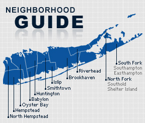
Long Island has a climate that is very similar to other coastal areas of the Northeastern United States; it has warm, humid summers and cold winters, but the Atlantic Ocean helps bring afternoon sea breezes that temper the heat in the warmer months and limit the frequency and severity of thunderstorms. In the wintertime, temperatures are warmer than areas further inland (especially in the night and early morning hours), sometimes causing a snowstorm further inland to fall as rain on the island. However, measurable snow falls every winter, and in many winters one or more intense storms called nor'easters produce blizzard conditions with snowfalls of 1-2 feet and near-hurricane force winds.
Temperatures in Nassau and Suffolk are similar. The winter average for Nassau is 33.7 degrees Fahrenheit, compared to a summer average of 72.7 degrees. In Suffolk, the winter average is 32.4 and summer average is 71.9 degrees.
The Nassau area receives about 45 inches of rain, compared to 42 inches for Suffolk. Snow falls at about 26.9 inches per year in Nassau and 30 inches for Suffolk.