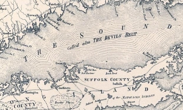


In the waters between Connecticut and mainland New York, flanked by Long Island, lies the Long Island Sound—an estuary acclaimed for its swift currents and perilous shoals, earning it the ominous moniker, The Devil's Belt. Among the most challenging stretches for mariners is the narrow passage connecting the East River and Long Island Sound, aptly named Hell Gate.

In 1614, the Dutch navigator Adriaen Block became the first European to document the presence of Long Island Sound as he sailed into the area from the East River. During colonial times, this area of the body of water was given the name The Devil's Belt and the treacherous reefs within it were referred to as Devil's Stepping Stones.
Read: Adriaen Block is First European to Identify Long Island as an Island
Early maps (like the one shown) labeled the Sound being also called The Devil’s Belt.