- Massapeuqa - 8.2"
- Wantagh - 7.84"
- Merrick - 6.81"
- Lido Beach - 5.3"
- Old Bethpage - 5.27"
- Bellmore - 5.2"
- Garden City - 4.75"
- Plainview - 4.7"
- Long Beach - 4.64"
- Syosset - 4.01"
- Muttontown - 3.41
- East Hills - 3.16"
- Floral Park - 2.8"
- Bayville - 2.63"
- Malverne - 0.98"
- Islip Airport - 13.27"
- Holbrook - 12.57 "
- West Islip - 11.50"
- Bay Shore - 11.35"
- Islip - 10.20"
- Deer Park - 8.40"
- Ronkonkoma - 8.20"
- Farmingville - 7.73 "
- Centereach - 6.71"
- St. James - 6.11"
- Smithtown - 5.17"
- Port Jefferson Station - 5.10"
- East Farmingdale - 4.93"
- Medford - 4.45"
- Mount Sinai - 4.40"
- East Northport - 4.40"
- Centerport - 3.18"
- Upton - 1.75"
- Stony Brook - 1.59"
- Shirley Airport - 1.15"
- Southampton - 0.70"
- Westhampton Airport - 0.68"
- Orient - 0.62"
- 1 NNE Montauk - 0.14"
Although the rain has stopped, and the sun is shining, some local roads may still be experiencing serious flooding and closures. Before you hit the road, be sure to check out LongIsland.com's Traffic Center, which features traffic updates in real time. You can also take a peek at the current traffic conditions over in our Traffic Cam Center, and get the latest transit updates over at our LIRR Schedule & Trip Planning Guide.
If your home has suffered flood damage, be sure to check out "What to Do After a Flood" - our Guide to proper clean up and sanitation post-flood. Flood waters can cause serious damage to homes, and proper post-flood clean up can help to prevent mold, and other serious problems down the line.
Have a photo of flooding in your neighborhood?
Email it to us, and we'll add it to our Floodageddon Photo Gallery.
How much rain did your neighborhood have? Let us know, and we'll update our list.
[Source: The National Weather Service.]
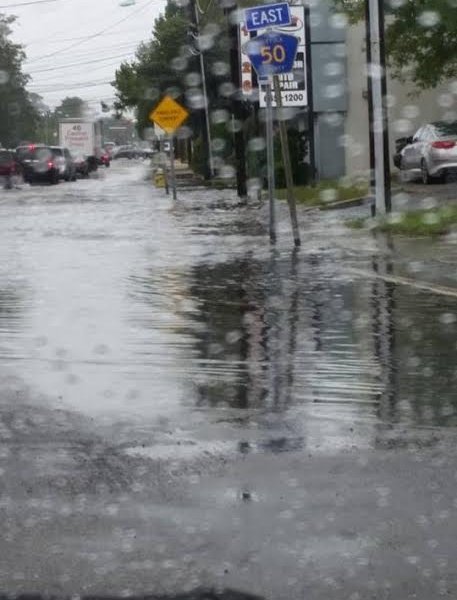
Pictured in the Feature Photo: Flooding on Union Avenue in Bay Shore.


