Weather for Long Island New York
Select Location:
Brookhaven
East Hampton
Glen Cove
Hempstead
Hicksville
Huntington
Islip
Kings Park
Middle Island
Riverhead
Valley Stream
Wantagh
Dew Point: 40°F
Wind: NW 1.8 mph
UV Index: 0 (Low)
Relative Humidity: 82%
Feels Like: 47°F
Visibility: 11 mph
Expect showers tomorrow night
Sunday
April 13
Showers
High 54°F
Lowi 42°F
Sunday Night
Mostly clear
Monday
April 14
Partly sunny
High 66°F
Lowi 48°F
Monday Night
Showers
Tuesday
April 15
Intermittent clouds
High 62°F
Lowi 42°F
Tuesday Night
Mostly clear
Wednesday
April 16
Partly sunny
High 52°F
Lowi 38°F
Wednesday Night
Mostly clear
Thursday
April 17
Sunny
High 59°F
Lowi 37°F
Thursday Night
Mostly clear
Hourly Forecast
Time
Temp
Condition
Precipitation
11:00 PM
45°F
0%
12:00 AM
45°F
0%
1:00 AM
44°F
0%
2:00 AM
44°F
0%
3:00 AM
44°F
0%
4:00 AM
43°F
0%
5:00 AM
43°F
0%
6:00 AM
42°F
0%
7:00 AM
42°F
0%
8:00 AM
45°F
0%
9:00 AM
49°F
0%
10:00 AM
54°F
0%
Long Island has a climate that is very similar to other coastal areas of the Northeastern United States; it has warm, humid summers and cold winters, but the Atlantic Ocean helps bring afternoon sea breezes that temper the heat in the warmer months and limit the frequency and severity of thunderstorms. In the wintertime, temperatures are warmer than areas further inland (especially in the night and early morning hours), sometimes causing a snowstorm further inland to fall as rain on the island. However, measurable snow falls every winter, and in many winters one or more intense storms called nor'easters produce blizzard conditions with snowfalls of 1-2 feet and near-hurricane force winds.
Temperatures in Nassau and Suffolk are similar. The winter average for Nassau is 33.7 degrees Fahrenheit, compared to a summer average of 72.7 degrees. In Suffolk, the winter average is 32.4 and summer average is 71.9 degrees.
The Nassau area receives about 45 inches of rain, compared to 42 inches for Suffolk. Snow falls at about 26.9 inches per year in Nassau and 30 inches for Suffolk.
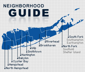
Nassau County Neighborhoods
City of Glen Cove
City of Long Beach
Town of Hempstead
Atlantic Beach
Baldwin
Bellerose Terrace
Bellmore
Bethpage
Cedarhurst
East Meadow
East Rockaway
Elmont
Floral Park
Franklin Square
Freeport
Garden City
Hempstead
Hewlett
Inwood
Island Park
Lawrence
Levittown
Lynbrook
Malverne
Merrick
Mineola
New Hyde Park
North Lynbrook
North Valley Stream
North Woodmere
Oceanside
Point Lookout
Rockville Centre
Roosevelt
Seaford
South Hempstead
Uniondale
Valley Stream
Wantagh
West Hempstead
Woodmere
Town of North Hempstead
Albertson
Carle Place
Floral Park
Glenwood Landing
Great Neck
Greenvale
Kings Point
Manhasset
Mineola
New Hyde Park
North New Hyde Park
Old Westbury
Port Washington
Roslyn
Roslyn Heights
Westbury
Williston Park
Town of Oyster Bay
Bayville
Bethpage
East Norwich
Farmingdale
Glen Head
Glenwood Landing
Greenvale
Hicksville
Jericho
Locust Valley
Massapequa
Massapequa Park
Mill Neck
Old Bethpage
Old Westbury
Oyster Bay
Plainview
Sea Cliff
Syosset
Woodbury
Suffolk County Neighborhoods
Town of Babylon
Amityville
Babylon
Copiague
Deer Park
Lindenhurst
North Amityville
North Babylon
West Babylon
West Islip
Wyandanch
Town of Brookhaven
Bellport
Blue Point
Brookhaven
Calverton
Centereach
Center Moriches
Coram
East Moriches
East Patchogue
Eastport
East Setauket
Farmingville
Holbrook
Holtsville
Lake Grove
Manorville
Mastic
Mastic Beach
Medford
Middle Island
Miller Place
Moriches
Mount Sinai
North Patchogue
Patchogue
Port Jefferson
Port Jefferson Station
Ridge
Rocky Point
Ronkonkoma
Selden
Shirley
Shoreham
Sound Beach
Stony Brook
Upton
Wading River
Yaphank
Town of East Hampton
Amagansett
East Hampton
Montauk
Sag Harbor
Wainscott
Town of Huntington
Centerport
Cold Spring Harbor
Commack
East Northport
Greenlawn
Huntington
Huntington Station
Lloyd Harbor
Melville
Northport
Town of Islip
Bayport
Bay Shore
Bohemia
Brentwood
Brightwaters
Central Islip
East Islip
Great River
Hauppauge
Holbrook
Holtsville
Islandia
Islip
Islip Terrace
Oakdale
Ocean Beach
Ronkonkoma
Sayville
West Islip
West Sayville
Town of Riverhead
Aquebogue
Calverton
Jamesport
Laurel
Manorville
Riverhead
South Jamesport
Wading River
Town of Shelter Island
Shelter Island
Shelter Island Heights
Town of Smithtown
Commack
Hauppauge
Kings Park
Nesconset
Saint James
Smithtown
Town of Southampton
Bridgehampton
Eastport
East Quogue
Hampton Bays
Quogue
Remsenburg
Sagaponack
Sag Harbor
Southampton
Speonk
Water Mill
Westhampton
Westhampton Beach
Town of Southold
Cutchogue
East Marion
Fishers Island
Greenport
Laurel
Mattituck
New Suffolk
Orient
Peconic
Southold